On 23rd August 2025, my best friend John and I set out to Scotland, or more specifically, the Scottish highlands, to spend the weekend in a camping hut and to hike Big Ben Nevis!!!! We arrived on the Saturday afternoon in a little town called Tyndrum, got settled into the camping hut at the By The Way hostel, and then drove 1 hour to Fort William to check out the Ben Nevis Visitor Centre car park and Fort William itself.

The Ben Nevis Visitor Centre opening times are 8am-4pm, and the toilets are also only open at these times. This car park is large and I believe there are other car park and camper van car parks nearby. You do have to pay on the machine and there is a nice map of the area with warning signs about climbing the mountain.
We had a lovely drive through the highlands and got out for photos with the scenery. There’s nothing quite like being in the middle of all those mountains. Here’s a picture of me near loch Tulla:

We went back to our cabin as tried to get some sleep before the hike, however the cabin’s walls felt like they were made of paper, and we were connected to two other cabins, and any little sound people made, we could hear. Safe to say I got about 4 hours sleep. Not the best when you’re doing a hike the next day.
24th August 2025.
We got up early and headed to the trail. Driving through the Scottish highlands in the dark is crazy and cool. I was very scared I would hit a deer, so I made sure I was taking it easy. The sides of the road were pitch black; you couldn’t see what was around you at all. We arrived at the car park as the sun was rising around 6am, and we easily got a parking space. We got ready and headed out.
It started off drizzling on the walk so we had our rain coats and layers on, but as we started walking we soon realised we were overdressed. It was too hot. We stripped off layers and had a break. The first 20 minutes is not too bad; just a normal hill climb but at this point you can’t even see Ben Nevis because he’s behind the corner.
Once you start to do the first zig zag, about 30 minutes in, that’s where the rocks get all random and point in different directions. Going up this is generally fine; but I knew coming back down them would be different. As I am still not as fit as I want to be, I did take lots of breaks during this part. I wasn’t able to do that zigzag walking tactic people do because the rocks were weird. I did try it though and I fell! Twice! Luckily they weren’t bad falls; I just slipped a bit, but yeah the rocks are dangerous! Some parts I even had to use my hands a bit to climb over things.
We passed a bridge and took some pictures, and at this point I think Ben Nevis was straight ahead of us, but I’m still kind of unsure where Ben starts and finishes!
In this picture you can see the mountain in the background, but I think Ben is still further than that. I might need to check a map! But yes, we zig zag up, then go around the corner to the left.

After that it’s just more rocky steps around the corner, but it’s quite straight (no zig zags) for a while. As you climb you can look over to your right and see people on the other side of the valley, climbing the mountain. You will soon be one of them as that is the trail you’re also taking. You reach some more turns as we zig zag slightly up onto a plateau where there is a small lake, but the steps here are more even and the view is incredible. I was still slow and taking lots of breaks though. I didn’t zoom up this like some people can! we sat on the grass overlooking the lake and had a snack!

We were really worried about the weather because it said it was going to rain and be bad, but honestly, the weather was perfect. There was only a bit of drizzle at the start, but no other rain than that, and the sky was patchy with clouds, so some blue came through, and the low clouds drifting over the valleys made for some absolutely stunning views! God damn!

If it was super clear I think we would have been able to see the sea, but I think we could just about vaguely make it out in the distance. After you reach the plateau and can see the lake on your left, the path bends round to the right and you start heading towards the mountain on the other side of the valley. Then you pass by a waterfall where people often fill up their water bottles, and you keep heading on up. This part, while still being tough, was very pleasant to walk up. The terrain was fine and the view was lovely, so we just have a nice chat and took our time.

After this part comes the gravel and scree. Honestly, it’s not too bad, but for someone of my fitness it is still very very tough, and many breaks are needed, but that’s normal for me. This gravelly scree section is a repetitive notorious zig zag section people don’t like. I kept having little conversations with other people making their way up too, commenting on the difficultly and asking how long left. I kept counting how many zigs and zags were left to go! lol.
When you finally reach the top of the zig zag and you think it’s over, it’s not. You still cannot see the peak from here. Well we couldn’t! Because it was foggy up there! After the zig zag you go up a slightly gentler incline of scree, and I can’t tell you much about the scenery from here as it just kept getting foggier and colder. I put my snood on my head like a bandana. We sat down and had another snack, but didn’t stay still too long as we were getting cold. There were many cairns as we traversed the gravel sections, and I could see them being very useful in bad weather to help hikers find their way.

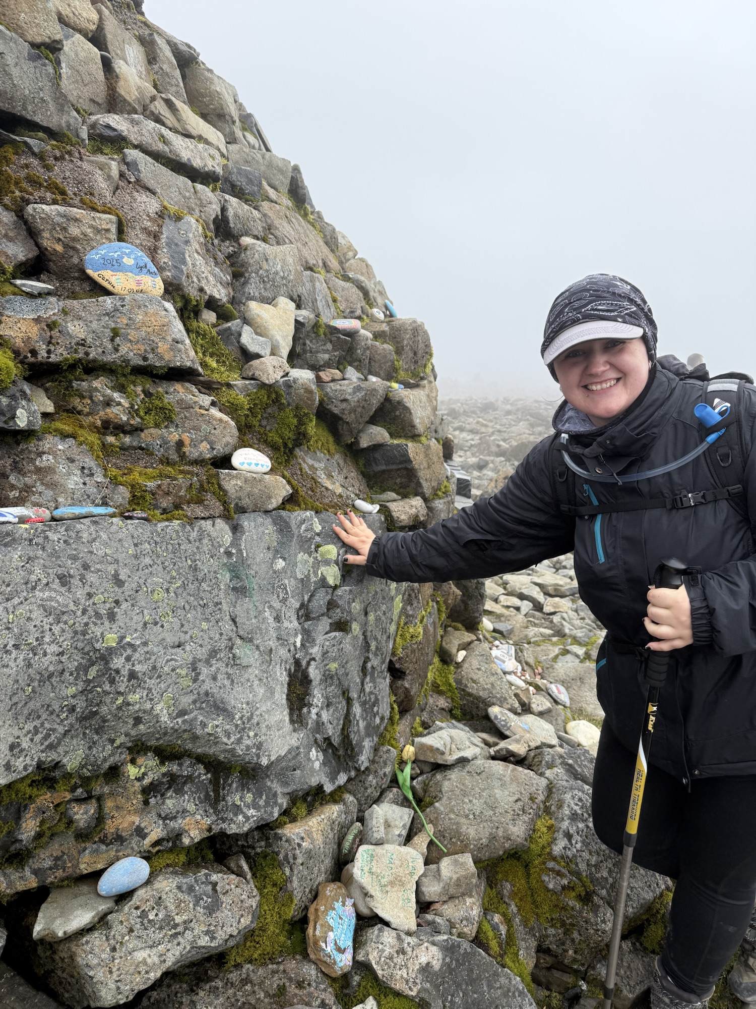
After another 20 minutes of walking to several fake peaks, the true peak finally came into view. There was a huge line for the summit picture on top of the rocky structure, and John and I chose to just take a picture standing next to it instead of waiting to climb it, because we were tired and cold and wanted to start the descent.

John climbed the shed/shelter thing and had a look inside. It had a lot of stickers in there and a little bed thing. We started the descent and to get out of the fog and cold. Walking down the scree boulders wasn’t as bad as I thought it would be! Honestly the first half of the descent wasn’t so bad. We had plenty of rests on rocks though. But as we got into the second half, we started feeling tired. On the part near the lake where we previously had our snacks, the terrain was nice so we literally jogged down this part, until we got to the weird rock section. I saw other people zoom down it but I was like HOW?! I had to take every step carefully, and in turn this made me more tired. We ran out of water, were tired, and started getting delirious. We somehow managed to scramble down and had about 20 minutes of walking left, and every step I took I was saying ‘oh god, oh god, oh god’. I was DONE.
Finally finally I saw the starting bridge! The one we had previously took a starter photo on!

And god when I saw that I was so happy, I was speed walking to my car. As soon as I got to it I ripped open the coolie bag and threw John a lucozade and opened my own. Stripped off my jacket and sat in my car, absolutely done.
So all in all, the ascent was fine; it was the descent that was baaaaad.
Afterward, we had pizza in Fort William and got ourselves some Ben Nevis magnets to commemorate our achievement. We had just conquered Ben Nevis!!! Wooo. I was so ready for a shower after that ahaha. We went back to the hostel, showered, and around 9pm the girl from the cabin joined on to us asked if we were able to quiet down now since she’s got an early start in the morning. She was so lovely about it and didn’t blame us at all, but mentioned how the walls are like paper. We said oh we know from last night! Haha. So we were like of course, well shut up now and go to bed. Once again I had a terrible night’s sleep. Any noise woke me up and the bed was an air mattress which wasn’t very comfortable. I got up around 4am and went to the toilet block. On my way back I saw a toad! How cool! Wish id have taken a picture. You could see stars so clearly in the sky too. It was so beautiful.
When I got back to the cabin John was already awake. Shortly after that we decided to go for a morning walk, since we did want to head home but we didn’t want to wake the girl next door by packing our bags.
We walked around Tyndrum and saw the beautiful highlands all around. The place was so peaceful and quiet at this time of day. There is a famous walk called the West Highland Way and it cuts right through Tyndrum and goes all the way to Fort William. We did see signs for it in Fort William, but in Tyndrum we saw the actual footpaths and maps for it. Very cool.
We got back to the hostel area and the girl from next door was just leaving, with her big hiking backpack on. We spoke to her and luckily she said she had a nice sleep and we found out she was doing the West Highland Way walk! She was on the way to Fort William. I think she had a day or two left of it. So cool. She sounded like she was from America. We said bye to her and then packed our bags and left for home.
On our way home we stopped by Loch Lomond and a few other beautiful places, just making the most of bank holiday Monday and our last day in Scotland.

I’m not sure if John and I are just crazy, or if a lot of people do what we do, driving 7 hours to Scotland to hike a mountain all in 3 days, but it was so worth it and I will be back! I’d love to do a nice flat walk and see the highlands in the winter and snow!
This is the first post I’m writing for my travel blog, and here’s to many more!
Leave a Reply